Washoe County Roads launches “Where’s My Plow?”
New interactive map for Incline and Crystal Bay allows citizens to see snowplows in real-time
Media Release
For Immediate Release
www.washoecounty.us
Contact: Amy Ventetuolo
aventetuolo@washoecounty.us
775.328.2070
Reno, Nev. Dec. 20, 2019. Washoe County Roads staff is pleased announce a new snowplow monitoring system which will provide the public with a near real-time interactive map to see where the high-elevation snowplow fleet is currently operating.
Each snowplow has been equipped with an Automated Vehicle Locator (AVL) system, allowing Washoe County Roads to more efficiently deploy the snowplow fleet during winter storms, as well as provide this online tool for the community to see which areas have recently been plowed.
“One of the most frequent questions that we get from the public is ‘where are the plows’,” said Eric Crump, Washoe County Community Services Operations Director. “This tool will help the public understand where we are and how we are working to keep the traveling public safe.”
The “Where’s My Plow?” interactive map is now live for the Incline Village and Crystal Bay areas at this time, with other higher elevation areas of the county possibly coming online in the future. “We are dedicated to helping the public get where they need to go during our winter storms,” said Sam Lair, Roads Operations Superintendent. “We are constantly looking for ways to use technology, like this AVL system, to help improve our operations and provide better service to travelers.”
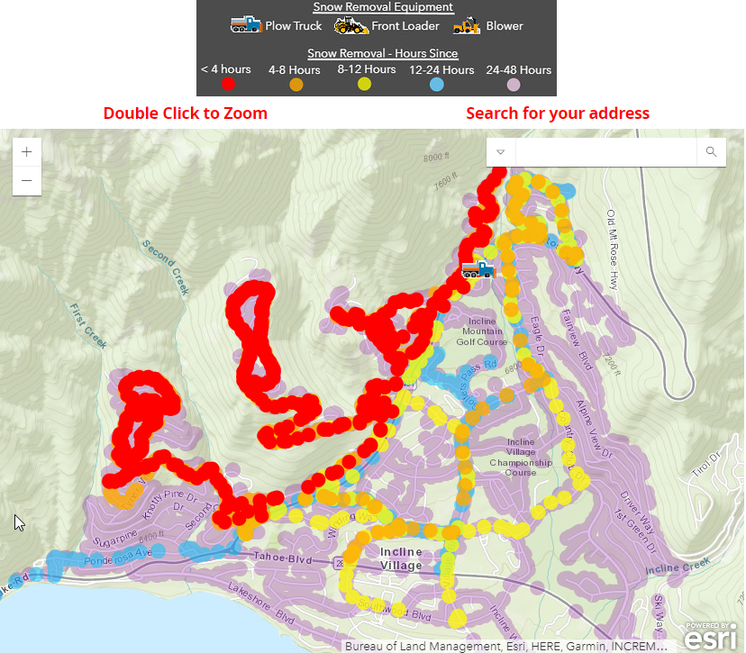 The public can view snow removal equipment locations and history for Incline Village and Crystal Bay by clicking here.
(Preview of “Where’s My Plow?” map pictured left.)
###